|
|
The Three final maps for the SCENIC TOUR POTM
A quick refresher: the task is to start at the upper left and move to
the lower right, and then return without reusing any grid points.
The distance traveled in any move is the vertical distance between
the points (with black=0 altitude and white=255 altitude).
The "score" is the ratio of the return trip to the first trip -
high score wins so it pays to "minimize" the initial trip and
"maximize" the return trip.

systest.pgm
input file
|
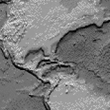
systest:
30x30 System Test Map (enlarged at left). All entries were run against this small
map to insure things were behaving properly. Weekly results
were mailed to all participants.
| |
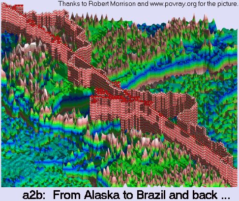
a2b.pgm
input file
|
a2b:
160x160 relief map of portions of North and South
AMerica. The trip from Alaska to Brazil (upper left to
lower right) and then the return makes for the first
challenge. The maximum round-trip length is 800 moves.
BEST SOLUTION SHOWN HERE.
| |
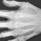
hand.pgm
input file
|
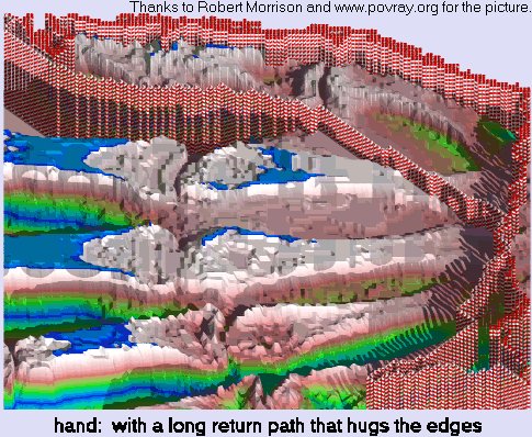
hand:
141x141 X-ray provides the second problem on the SCENIC TOUR POTM.
The start point is near the tip of the thumb.
For this one, we allow up to 1000 moves for the round-trip.
BEST SOLUTION SHOWN HERE.
| |
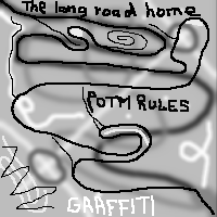
graffiti.pgm
input file
|
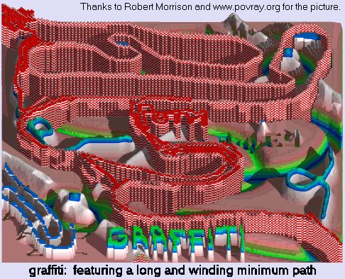
graffiti:
For the final scenic tour, we'll use a graffiti filled map.
Coincidentally, this 200x200 grid contains a winding road
which is almost all zero-altitude. The eye can pick out
the winding path, but I don't know which programs may be able to.
I also don't know if minimizing that first path will yield the
best score overall ... we shall see! For this one, the round-trip
path can be up to 3500 moves.
As it turned out, because of the large number of moves that
are allowed, the score of this grid tends to be much
larger than that of the other two.
BEST SOLUTION SHOWN HERE.
| |
The definition of the "Portable Gray Map" pgm input files
are given at this link.
|